EGYPT.GEOLAB.CZ
These pages inform of activities of Geoinformatics Laboratory in the
archaeological research carried on by Czech
National Centre of Egyptology and
Czech Institute of Egyptology
on the Czech concession in Egypt.
The Laboratory provides complete
support of the research in the field of geoinformatics - geodesy,
cartography, GIS application, Remote Sensing and GPS survey.
![]()
![]()
Geoinformatics in Abusir Archaeological Research - PDF
Satellite Image of Abusir,..... - PDF
Autumnal Season 2002 in Abusir , more details here
Spring Expedition 2003 - Bahariya Oasis, El-Hayez area.
Final report in English
On-line news on the National Geographic web page.
Satellite image of pyramid fields -
Abusir, Saqqara, Dahshur
Satellite image of the Abusir Pond
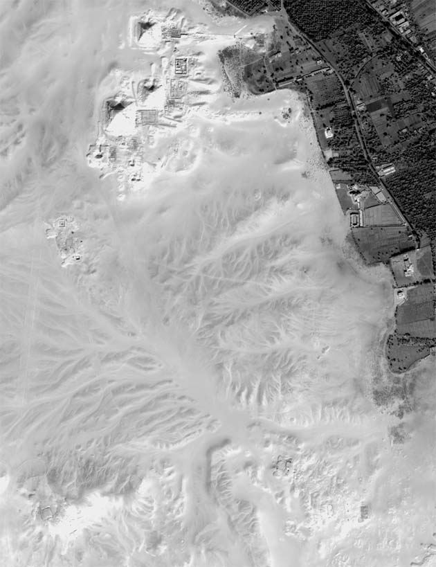
Panchromatic
image of Abusir
Virtual view of the
Kaaper's tomb, also see the PDF
format
Photogramm of the Vizier Kar's burial
complex
Abusir from various perspectives -
PDF
Shaft "A" of Inti's burial complex - PDF
![]()
![]()